


The Weather Plot Thickens
Grab some popcorn

When your bodacious hack meteorologist last left you in early November, I argued that the Mid Atlantic drought would be ending over the ensuing few weeks, and the northern jet stream would soon return us to a more seasonal pattern.
I was right (look, I had to type those three words because I don’t get the opportunity all that often. And I have to tell you, it felt really good).
With that self-indulgence out of my system, let’s take a look at the next couple weeks. Before I do that, let’s first offer a nice golf clap to the Snow Miser for those two mini snow events over the last week, which left us with a seasonal white landscape for the holidays, and will continue to rehydrate local soils. We need a lot more, sure, but compare the current experience to the warm and dusty landscape that I described six weeks ago. Things can change quickly.
So let’s take a look at what’s going on. First, a quick look at the upper atmosphere:
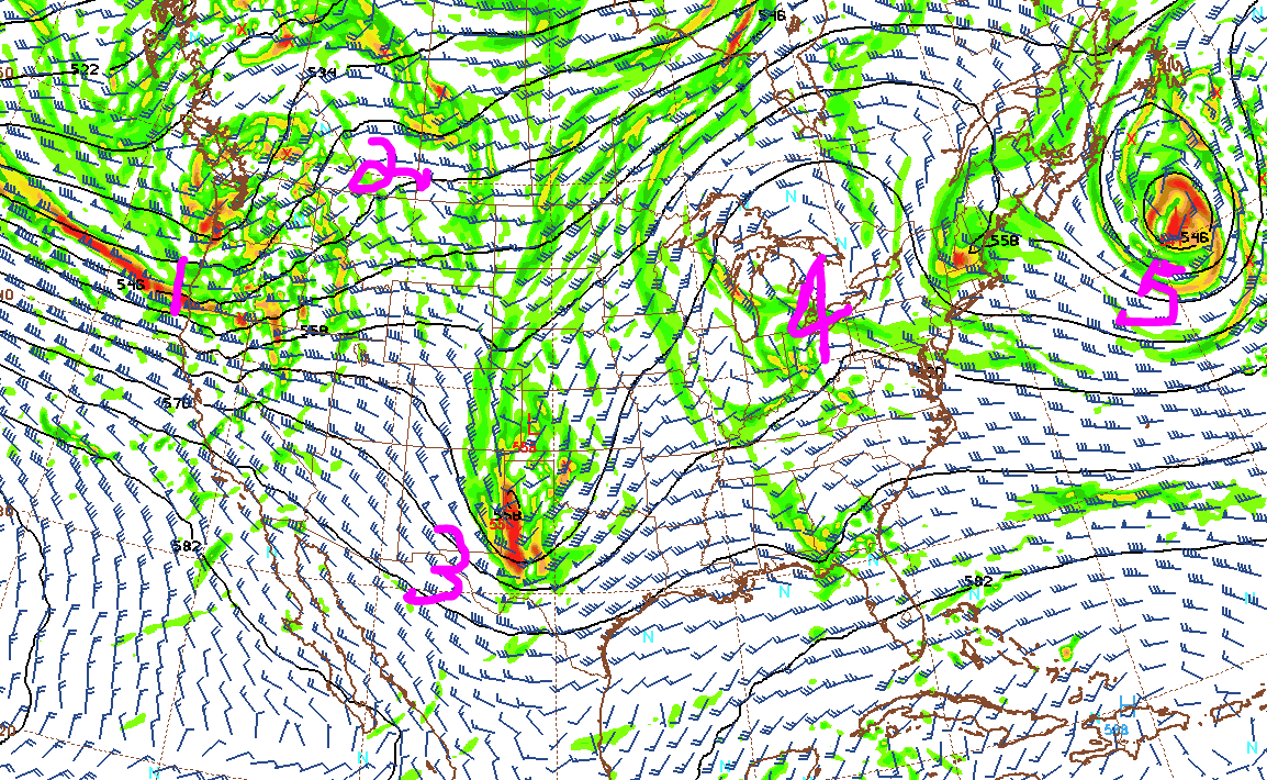
The first thing we notice is that I can still count to five. And I got a super-cheap but cool pen mouse thingee that let’s me draw over perfectly good weather maps more effectively. So that’s good. But the real takeaway is that, as I write, there’s a heck of a lot of activity way up there in the friendly skies. Working backwards: low pressure exiting over the North Atlantic, a brief warm-up, the opening act energy for the next precipitation event, some wild card features that we will need to watch, and, finally, the headliner energy for what will likely be a very wet weekend and start to next week.
So those are the ingredients. Here’s a look at what the baking cake looks like on Sunday, a little lower in the atmosphere:
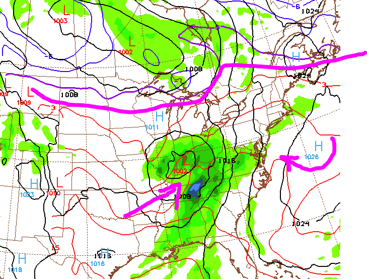
Summarizing the blobs and squiggles, it’s gonna rain this weekend. All the cold air is up in Canada, the upper atmospheric energy from the previous graphic is now doing the dirty work of generating a storm, and high pressure over the ocean will be injecting moist air into the setup. This could turn into three or four days of rain, perhaps as much as two inches.
Drought? What drought? You will be washing the dog’s paws a lot in the coming days.
[in best Monty Hall voice] But wait, there’s more! When we open Door #3, here’s what we see:

The model is saying that, by the middle of next week, the high pressure over the ocean is receding, cold air in Canada is rushing into the midwest, and another blob of moisture is cruising through the Mid Atlantic — the pattern is evolving again. By next Friday, the upper atmosphere looks like this:

Ruh roh. I’m not going to bother talking about what the model currently thinks will happen closer to the ground in that time frame — tiny changes will alter that picture considerably. But the general evolution of the upper air pattern is likely correct. And if that’s true, we are looking at two possibly significant storms the following week. Both are potentially snow, though neither is at the moment, as depicted. Again, the details matter, and it will be another week before we can say anything beyond rank speculation. But if you haven’t checked the snowblower yet, I would take care of that over the next week or so.
Bigger picture, the takeaways are:
The meteorological drought is over (and has been for a month).
Plenty of rain in the near term.
Possible east coast snow storm(s) in the longer term.
Temps will be a bit of roller coaster ride through the entire period.
Enjoy the rest of the holiday season.
For more reflections about gardening and the broader life lessons it bestows on us, feel free to check out my online book, Life Lessons of a Backyard Gardener, which I am publishing here, one chapter at a time.